


Sunday, January 08, 2006
Eye In The Sky
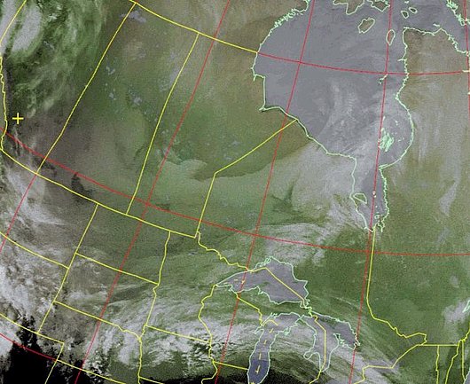 This Image was downloaded by me in real time off of NOAA 18 (a weather satellite), at the time 1600 kilometres east, and 800 kilometres up. AOS was 121 degrees, and LOS was 353 degrees. This image was a 15 minute download via my QFH antenna, to my Wefax Receiver, then using WXtoImg software, my laptop decoded the audiofile, giving me this final image. I can do this at home in my hamshack, or from my truck when stormchasing. By the way, I placed the map overlay on the image. I can also zoom in. I created this image from my mobile. Check it out on my webpage.
NOAA 18 (ch 2-4, northbound 24E) at 2006-01-08 19:12 UTC
www.stormchaser.cjb.net Quadrifilar Helix

No comments yet